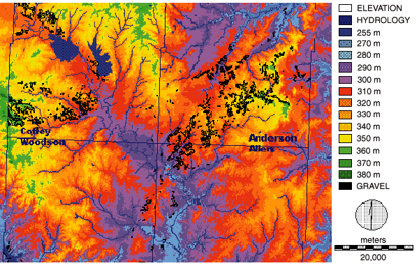
Fig. 10. Neosho chert gravel deposits. Digital elevation model for parts of Anderson, Coffey, Woodson, and Allen counties. Detailed distribution of upland chert gravel (Olpe soil) outlined in black; elevation classes shown by color coding. Model has 90 m (300 ft) resolution; derived and corrected from DEM-24K; UTM coordinate system. Digital elevation model obtained from the Kansas Geological Survey--DASC. Image processing by R. Byerley and N. Wilkins.
![]()
Kansas Geological Survey
Web version March 18, 1998
http://www.kgs.ku.edu/Current/1997/aber/fig10.html
email:lbrosius@kgs.ku.edu