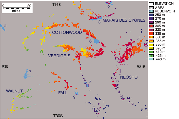
Fig. 8. Kansas chert gravel (Olpe Soil) map. Raster grid of upland chert gravel deposits (Olpe soil) in eastern Kansas, according to township-and-range grid. Each pixel represents one quarter section in area (0.25 mile2, 0.65 km2); pixels are color coded according to elevation classes. Numbers indicate man-made reservoirs: 2 = Pomona, 3 = Melvern, 5 = Marion, 6 = John Redmond, 7 = El Dorado, 8 = Toronto, and 9 = Fall. See also Fig. 2.
![]()
Kansas Geological Survey
Web version March 18, 1998
http://www.kgs.ku.edu/Current/1997/aber/fig8.html
email:lbrosius@kgs.ku.edu