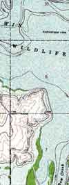
For years, people who wanted detailed
maps of Kansas reservoirs had to splice together several different topographic
maps. Now the Kansas Geological Survey has produced individual topographic
maps for each of the state’s major lakes and several of its wildlife
refuges.
Each map depicts an entire lake, along with surrounding roads, houses,
quarries, and other features. The maps are printed on water-resistant
paper, ideal for use while fishing, hunting, canoeing, or hiking.
Maps are available for Tuttle Creek, Wilson, John Redmond, Glen Elder,
Kirwin, Cedar Bluff, Marion, Clinton, Perry, Melvern, Norton, Pomona,
Cheney, Toronto, Fall River, Elk City, Milford, Kanopolis, Webster, El
Dorado, La Cygne, Lake Shawnee, and Lovewell reservoirs, along with the
Cheyenne Bottoms and Marais des Cygnes waterfowl areas and the Quivira
National Wildlife Refuge. The maps cost $15 each, along with taxes and
handling. Most of the lake maps show lake-bottom topography.
For more information, to order a map, or to get a copy of a brochure that describes all the maps, call the Survey at 785-864-3965 or check the Survey’s home page at www.kgs.ku.edu.
Reservoir
Maps Now Available

Segment of Kirwin Reservoir Map with lake-bottom topography.
Angela Epps, earth science teacher at California Trails Junior High School in Olathe, has received the 1999–2000 Excellence in Kansas Earth Science Education Award from the Kansas Geological Foundation and the Kansas Earth Science Teachers Association. This award of $1,000, funded by the Kansas Geological Foundation, is given to an outstanding earth science teacher in grades K–12. The award was presented in December at the Kansas Geological Foundation’s annual meeting in Wichita. Finalist for the award was Bill Dymacek of Nike Middle School, Gardner, who received a gift certificate for publications from the Kansas Geological Survey. Epps is the seventh recipient of the Excellence in Kansas Earth Science Education Award. The 1998–99 winner was Beverly Ring, from Oregon Trail Junior High School in Olathe.
Earth Science Teacher Honored
URL:http://www.kgs.ku.edu/Publications/GeoRecord/2000/vol6.1/Page3.html