Bourbon and Cherokee County Geologic
Maps
New geologic maps of Bourbon and Cherokee counties are now available
from the Kansas Geological Survey. They are part of a series of new geologic
maps of the counties in the state.
The maps depict the age and type of rocks at the earth's surface
and show other geological features, such as faults and folds. Geologic
maps are useful in construction, in understanding soils and agriculture,
in searching for water and mineral deposits, and in a variety of engineering
and environmental uses. The maps also show roads, towns, rivers and lakes,
railroads, coal mines, quarries, and other features.
The Bourbon County geologic map, compiled by geologists Ronald R. West,
of Kansas State University, and Robert S. Sawin, from the Kansas Geological
Survey, is the first geologic map of the county ever published. It includes
a cross section of the rocks beneath the county and a brief discussion
of the county's geology. Most of Bourbon County is covered by limestones,
shales, and sandstones deposited during the Pennsylvanian Period, about
300 million years ago. Coal was mined from these rocks in eastern parts
of the county.
The Cherokee County geologic map, by Tulsa geologist Allan P. Bennison,
depicts the oldest rocks exposed at the surface in Kansas—Mississippian-age
rocks deposited about 340 million years ago and mined for lead and zinc
until 1970. These rocks occur in the extreme southeast corner of the county.
The rest of the county is covered by sandstones, shales, and limestones
deposited during the Pennsylvanian Period. Much of this portion of the
county was extensively mined for coal.
Each full-color map is drawn at a scale of 1:50,000 (one inch equals about 3/4 of a mile). Copies of the new maps are available at the Kansas Geological Survey, 1930 Constant Avenue, Lawrence, KS 66047-3726 (or call 785-864-3965) for $15.00 each, plus tax, shipping, and handling. More information about the maps and other Survey products is available at the Survey's web site.
Atchison-area Landslide Potential Map
A new map of the Atchison vicinity shows areas where the long-term likelihood
of landslides is higher. With its steep slopes, high average rainfall,
and increasing urbanization, this part of Kansas has the potential for
more damaging landslides than most other areas of the state.
The map, compiled by Survey geologists Gregory C. Ohlmacher and John
C. Davis, shows that the probability for landslides is relatively high
along the steep bluffs of the Missouri River and the steeper slopes along
drainages such as Deer Creek, Whiskey Creek, and Walnut Creek.
Landslide-hazard Map of the Atchison West and East 7.5-minute Quadrangles, Atchison County, Kansas, is drawn at a scale of 1:36,000 (one inch on the map equals just over 1/2 mile). Copies of the map are available for $15.00, plus tax, shipping, and handling from the Kansas Geological Survey (see above address).
New
Publications
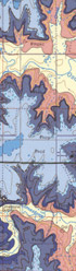
A segment of Bourbon County Geologic Map.
Years
of Kansas water data are available at the Survey's web site, along
with new tools that allow users to map or graph these data in the ways
that best fit their needs. By going to the KGS
Water Resources Information Page, users can search two Survey water-related
data bases.
One is the water-well completion data base (WWC5), which includes logs
of the subsurface geology encountered during the drilling of wells. Users
can search that data base by legal description or look at all the wells
in a given county.
The other data base (WIZARD) has depth-to-water information for wells.
At the site, users can select wells, either by legal description, the
latitude and longitude, the county or counties, or the groundwater management
district. By clicking on the "select wells" button, users
retrieve all depth-to-water records for wells in the area they've
selected. By clicking on "create map," users can create an
interactive map of the wells they've selected. The "regional
trends" button provides a simple graph of water-level changes for
all the wells they've selected.
"This newly enhanced web site does more than provide data," said Survey water-data manager Brownie Wilson. "The site turns that data into information that can help guide decisions."
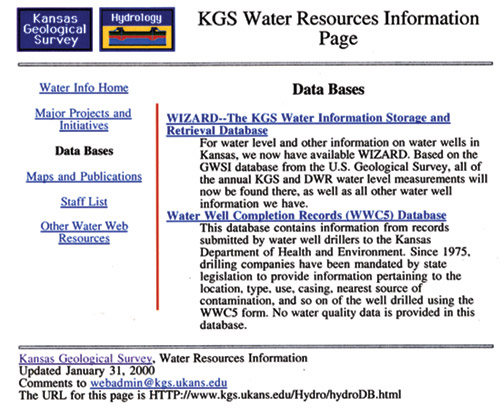
Water resources information on the KGS site.
Online Water Data
URL:http://www.kgs.ku.edu/Publications/GeoRecord/2003/vol9.2/Page3.html
Online July 18, 2003
Comments to: lbrosius at kgs.ku.edu
Kansas Geological Survey